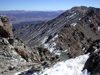
North Halfmoon Creek Trailhead - 10,500 feet
From I-70 and C-470 in Denver, drive west on I-70 for 65 miles to Exit 195 (Copper Mountain). Go south for 32 miles through Leadville, Colorado to CO Hwy 300 and to a sign addressed “Leadville National Fish Hatchery”. At the sign, turn right (west) onto a paved road. Drive a half-mile then turn left (south) onto Lake County 11. This is a dirt road. Turn right (west) and drive approximately two miles on another dirt road called, FR 110. This road will be marked with a sign, “Halfmoon Creek”. Pass two campgrounds, the Mount Massive Trailhead (north side), the Mount Elbert Trailhead (south side), and two parking lots (one being an overflow for the summertime summit conventions (ha-ha)). After this point the road declines in quality and low clearance vehicles will have to slow down for an additional two miles. The deterioration increases considerably and a four-wheel drive vehicle is needed for the final half mile to the Trailhead. The Trailhead is at the creek crossing and is marked, “North Halfmoon” access. Located here is also a small parking area.
 |  |  |
Route Description
The ‘granddaddy’ of Mount Massive, the Tour de Massive, will take you on a completion loop of five summits above 14,000 feet. These five summits include: Point 14,169 (14,169’ - not official), North Massive (14,340’ - not official, but close), Massive Green (14,300’ - not official), Mount Massive (14,421’ – official), and South Massive (14,132’ - not official). As an added bonus this loop includes over 1 ¾ miles of hiking above 14,000’, and is the only mountain in the lower forty-eight states that includes this extended distance at such a high elevation. ‘Dipping back’ into the thirteen thousand feet range doesn’t exist until the saddle between Mount Massive (14,421’ – official) and South Massive (14,132’ – not official), but its natural depression is still 13,900’.
Start the excursion on the, “North Halfmoon Trail” (10,400’) and hike
through a stunning valley towards “Half Moon Lakes”. There is a creek
crossing and a small waterfall at approximately 12,300 feet. At this
junction, leave the trail, being careful not to cross the creek, and
remain on the east side. There isn’t a well-defined trail located here
so remember while hiking into the basin, stay on the east side of the
large tower that forms North Massive’s southwest ridge. From here,
Mount Massive is at the right and North Massive is straight ahead with
its impressive south face. There are numerous large boulders to hike
around, once in the small basin. Looking to the northwest (somewhat
left), there is a 400-foot scree slope that ascends to the southwest
ridge and leads to North Massive (14,340’ – not official, but close).
Carefully continue up this slope. The rocks are extremely loose. This
section consists of ‘two steps forward and one step back’, which is the
hardest part of the hike. Once on North Massive’s southwest ridge,
Point 14,169’ (not official) is the large rounded summit to the
Northwest. This is an easy hike to the summit. This summit is unique
because it is the only 14,000 foot point that’s on the Continental
Divide in the Sawatch Range.
From Point 14,169 (not official), North Massive (14,340’ – not official,
but close) will be due east with two summit points. The true summit,
for North Massive, is on the right, or the southeast summit. This peak
is also a significant summit since it’s the fifth highest point in the
state, but it’s not an official fourteener. North Massive is 0.9 miles
from Massive, which includes a 280-foot rise from the saddle. Under
today’s rules, it’s only 20 feet from being official, but the rules seem
to change over the years. Maybe someday North Massive will be listed.
The descent to the saddle between North Massive and Massive Green is an
easy Class 3 to a Class 2+ scramble, depending on the route. If you
tumble toward the northeast, away from the North Massive's south face,
there will only be some minor skittering. Next, there are only a few
spots to down climb, facing out, using all fours. From the saddle
(14,140’), on the way to Massive Green, there are a couple of pinnacles.
Pass them on the right (west) staying about twenty to thirty feet
below the ridge. This is the safe route. Follow the trail for an easy
hike to Massive Green (14,300’ – not official).
From the saddle of Massive Green and Massive (14,240’) it’s an easy
hike, by staying on the ridge, to the Mount Massive’s summit. Follow
the trail to the Massive-South Massive saddle at 13,900’. Staying on
the broad ridge, the final 250 feet to South Massive’s summit is an easy
hike. By this time you might be having second thoughts on completion
due to the difficult day. This final elevation gain, as it turned out,
is the easiest saddle climb. Go for it!
Back at the saddle between Massive and South Massive, there is a faint
trail that leads down to the valley (the West Slopes). Follow this
steep, and somewhat loose trail, back to the “North Halfmoon Trail”.
The days hike entails 9 miles round trip and 5,000 feet of elevation gain.
 |  |  |  |  |
Essential Gear
Necessary item's :
Good Boots
Wind Gear.
Water.
There isn't allot of water along the route.
Any other essential gear needed for a long day.
Miscellaneous Info
Climbing and hiking is dangerous and approach this peak with caution. The conditions may vary depending on the time of year. It is up to the climber in making good decisions and safe climbing techniques for themselves.
 Sawatch Range


